Big Bend National Park
April 10
We decided to maximize time in Big Bend we would spend a full day driving straight to the Rio Grande Village campsite from North Dallas. We set out early to leave time before sunset to setup camp. We chose the Interstate 20 route west and the cross country version on the way home.

The three little ones did remarkably well on the long haul. We made a handful of pit stops including the visitor center in Fort Stockton, TX pictured. We stocked up at the grocery before continuing south to the National Park.


Entering the park is as simple as passing the pictured sign. A few miles in later an unmanned gatehouse near the northern Ranger Station. We came in from Marathon, TX which is 40 miles from the entrance followed by another 26 miles into the park center to reach the Panther Junction Park HQ. Some views on the way in of the Chisos Mountains. The vast size of this park is impressive knowing the distant mountain range is in the middle of the park.


April 11

Good morning.
Breakfast on the Coleman Grill. This was a huge improvement over breakfast on the charcoal grill.

Panther Junction Park HQ

Checking out a skull at the Panther Junction Park HQ. This skull was hidden around the side of the visitor center. Then off to hike the Lost Mine Trail. We started the day getting orientation from the rangers. I asked about road conditions for our second day off road and got some tips on our itinerary.
Chisos Basin

View from about halfway up the Lost Mine Trail. We didn't quite make it to the top of the ridgeline, but we had some excellent views east along the trail. The girls enjoyed looking out for the mountain lions and bears that have been seen in the area. We saw no animals on the trail.
http://visitbigbend.com/hiking summary of Lost Mine Trail:
Medium difficulty. 4.8 miles round trip. Self-guiding booklet available at trailhead.
Beginning at Panther Pass on the Basin Road, this trail serves as an excellent introduction to the plants and animals of the high Chisos Mountains. It starts at 5600' elevation and leads upward along the northern slope of Casa Grande to a promontory high on the ridge separating Pine and Juniper Canyons.
From the end of the trail, at 6850' elevation, you can see upper Pine Canyon to the east, and Juniper Canyon far below to the southwest; the East Rim forms a high backdrop behind Juniper Canyon.
If you have limited time, hike only to the Juniper Canyon Overlook (Stop 12 in the self-guiding booklet), one mile from the trailhead, for one of the finest views in the Park.
 |
| Casa Grande in background |
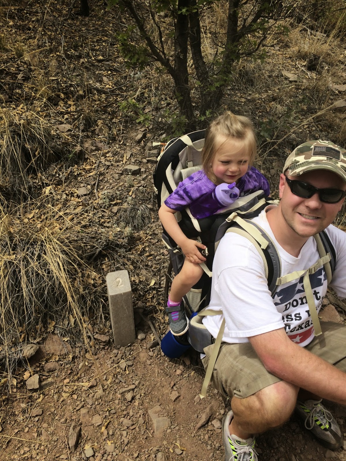
A quick break at the 2 marker with the two year old. The Kelty carrier backpack was another great improvement to the trip. We used it on all the long hikes.
 |
| lunch at the Chisos Mountain Lodge view of the 'The Window' |
Open at 7:00-10:00 am for breakfast, 11:00am-4:00 pm for lunch with dinner served from 5:00pm - 8:00pm
 |
| The Window |
We hiked around after lunch at the lodge in the Chisos Basin. There are lots of trails and loops of varying distance starting near the Chisos visitor area.
 |
| Casa Grande |
 |
| Park road towards Rio Grande Village heading southeast |

We had dinner at camp and then headed for a walk at the nearby Rio Grande Village Nature Trail.
 |
| Rio Grande facing west |


Trail Summary:
Rio Grande Village Nature Trail
Easy walking. .4 mile loop trail. Interpretive signs along trail.
Easy walking. .4 mile loop trail. Interpretive signs along trail.
Beginning in the southeastern corner of the Rio Grande Village Camp-ground, this trail passes through dense, jungle-like vegetation of the river floodplain, and then climbs abruptly into the arid desert environment. A high promontory provides panoramic views along the Rio Grande and south into Mexico. Downriver is the Mexican village of Boquillas, Coahuila State, Mexico, and Boquillas Canyon. Upriver are sand dunes on the Mexican side, and the distant Chisos Mountains beyond Hot Springs Canyon. Just across the river is the little farming village of Ojo Caliente (Spanish for "hot spring"). The fields are irrigated by water from warm springs that surface along the limestone bluff on the east side of the clearing.

We made it back to camp at near sunset. One day of adventure down.
Stay tuned for the next day of even bigger adventure. A whole day offroad....
No comments:
Post a Comment